
 Land surveyors are typically highly qualified specialists with a competitive salary to reflect their level of experience and competence. But what is day to day life like for people working as a land surveyor?
It can depend on whether a deadline is coming up, or the nature of the project you are working on; and while surveying is typically a 9-to-5 job five days a week, there are exceptions, including early starts, late finishes, and sometimes work at the weekends too.
The nature of the job also means that you will need to travel to get to certain sites – often over long distances or to locations where you will have to stay overnight. For obvious reasons, therefore, a full clean driver’s licence is an important, if not essential attribute.
Areas of interest
Land surveying is best suited to individuals with a keen interest in mathematics, science and/or engineering. Whilst this is generally not an issue for most younger people seeking to pursue a career in land surveying today, an understanding of technology and computers is pretty important.
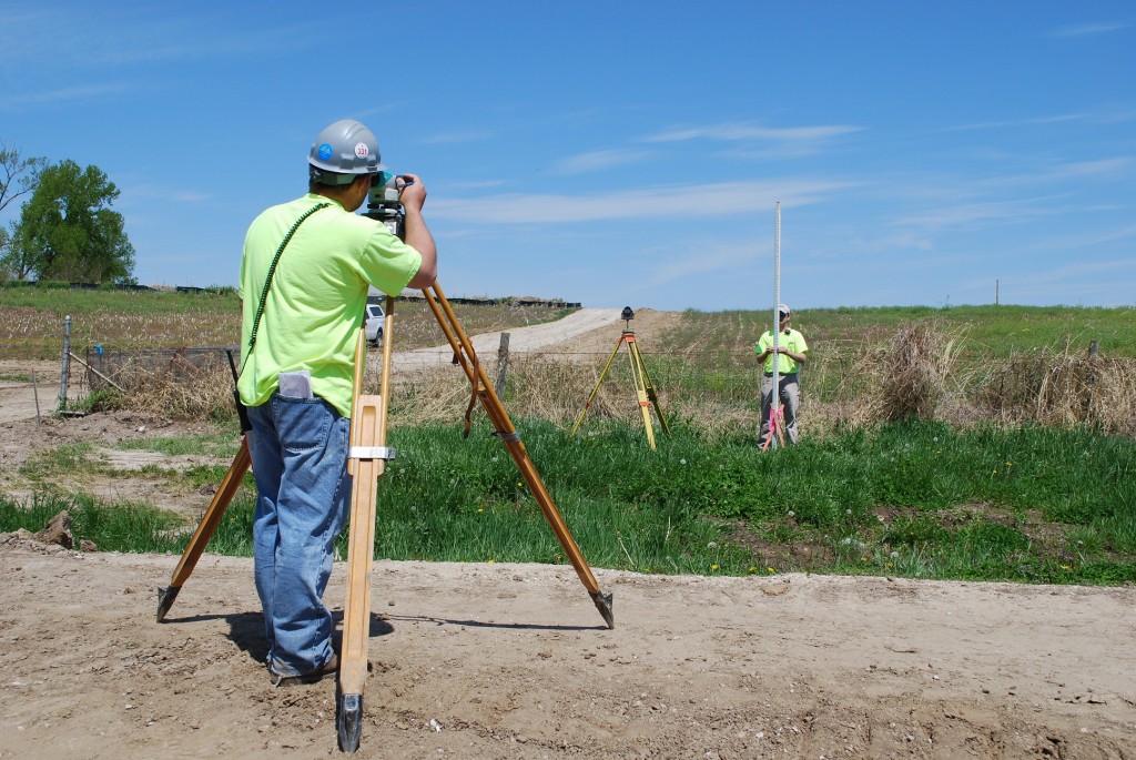
Whilst a substantial portion of your time will be spent at home or in the office downloading, processing and interpreting data, most of your time will inevitably be spent in the field gathering that data. Whilst being an avid fell runner or hiker is absolutely not a requirement (!) it’s absolutely vital that you enjoy working outdoors and that you remain a reasonable level of fitness at all times. Depending upon the nature of the project you could end up walking a number of miles each and every day. It will be your responsibility to ensure that you are physically capable of that level of exercise.
It goes without saying that an interest in whichever sector you choose to involve yourself in (railways, civil engineering, archaeology, heritage etc.) would be highly advantageous, both for your own sense of fulfilment and enjoyment and for your prospects within that field.
On the job
Land surveying work is, in the simplest possible terms, mapping a site to produce an up to date record of the area as is. This can be in order to record and preserve a historic site or monument, to provide a picture of a site before any engineering or construction work is carried out and so on.
Land surveyors typically have a central role in decision-making, for example confirming that construction plans are workable following initial assessments of the site and the likely environmental impact.
You will also spend time on 2D and 3D CAD drawings of the site, which could be any construction project from mines and quarries, to transportation infrastructure including bridges and tunnels, to utility supplies including power and water.
Hydrographic surveys, mentioned earlier, involve at least some work on water – this can be offshore, such as oil and gas infrastructure and seabed exploration, but could equally be inland working on and around rivers, or dredging clogged canals.
Who do you work for?
Land surveyor opportunities are available from a wide range of companies all over the world, although in many cases each company will only employ a relatively small team in-house, with some larger outsourced surveying specialists. The vast majority of successful candidates will end up working for dedicated surveying companies.
You may be employed directly by a construction company, an engineering contractor or a specialist geophysics or geomatics consultancy.
In the public sector, government agencies can sometimes provide employment opportunities within land surveying especially on large central infrastructure projects, and this can extend to regional opportunities with local authorities.
The big mining companies, oil and gas developers and so on have larger in-house teams, and there are direct cartographics roles mapping some of the remaining remote parts of the planet, as well as undersea exploration.
For the future
It’s not as simple as getting into a job and staying there without developing your personal skills any further – if for no other reason than because technology, equipment and techniques are evolving all the time too.
Geomatics is one prime example of where new technology has led to rapid development of a specialist skill set within the industry, and this is now one of the career paths you can pursue using RICS training to work towards chartered status.
There are also pathways focusing on rural environments, mineral usage and waste management, giving you several options of how to progress.
RICS offer several different ways to complete their Assessment of Professional Competence, to suit those who have entered the profession through more academic or more vocational routes, by balancing these with more on-the-job training or more direct professional development.
An alternative is to consider the classes and qualifications available from the Institution of Civil Engineering Surveyors, which can fill in smaller gaps in your CV or help you to pursue specific areas of interest.
Perks and Benefits
Working as a land surveyor is challenging and requires a considerable level of expertise, but on top of your salary you can often expect some benefits and perks of the job, which may include:
- Company car for driving to and from remote sites – this depends upon the company in question. Some may provide an allowance or expect you to use your own vehicle, paying you by the mile.
- A generally high-standard accommodation paid for during overnight stays.
- Paid overtime may be available during busy periods.
- Mobile phone allowance and pension contributions – the level of these contributions will depend upon the company.
Combined with the varied day-to-day job depending on the project at hand and the inherent change of scenery week in, week out, these can be the icing on the cake, making working as a land surveyor the perfect career path for those with the right skill set.
Thanks to City Surveys And Monitoring for this interview – Leading UK based measurement experts, offering a wide range of services for many industries, including Topographic surveys, Utility mapping and ground investigation.